Manual preview · optional relative orientation
Direct the sky before you set the tripod
Enter a location and UTC time yourself, then project the horizon, celestial poles and exposure, gap and full-sequence trail arcs across your camera frame. Nothing is guessed, uploaded or saved.
This deterministic planner adds low-precision Sun, Moon and geometric twilight facts. Manual planning needs no permission. An optional consent-first orientation preview can follow relative phone movement after you align it yourself; it never requests location or camera access and does not claim true north, AR or device support.
1 · Describe the shot
Manual plan
Inputs are ready. Generate the plan when the values match your intended shot.
2 · Inspect the projection
Camera-frame sky map
No scene yet
Optional · object URL only
Use your photo as a local backdrop
Select one JPEG, PNG, WebP or AVIF up to 32 MiB. The page gives the browser a temporary object URL only: it does not inspect EXIF, decode pixels in application code, store the file, send it, or add it to analytics. Deterministic trails remain a separate SVG layer above it.
No photo selected. The numeric plan is unchanged.
Horizon
Full sequence
One exposure
Shutter gap
Celestial pole
Sun, when above horizon and in frame
Moon, when above horizon and in frame
Optional · relative movement only
Phone direction preview
Manual planning requests nothing on load; orientation code loads only after the first explicit Enable activation, permission can be requested only after a second explicit activation, denial or unavailability leaves the manual planner unchanged, and location and camera access are never requested. Point the phone at the planned frame before enabling. The first valid sample becomes a temporary manual alignment; movement after it draws a relative pointer over the deterministic scene. This is not true north, a camera view, AR or a device-support claim.
Off. No orientation module, sensor listener or permission request has run.
Local file · privacy projection
Share a plan without sharing where you stood
Phone handoff QR
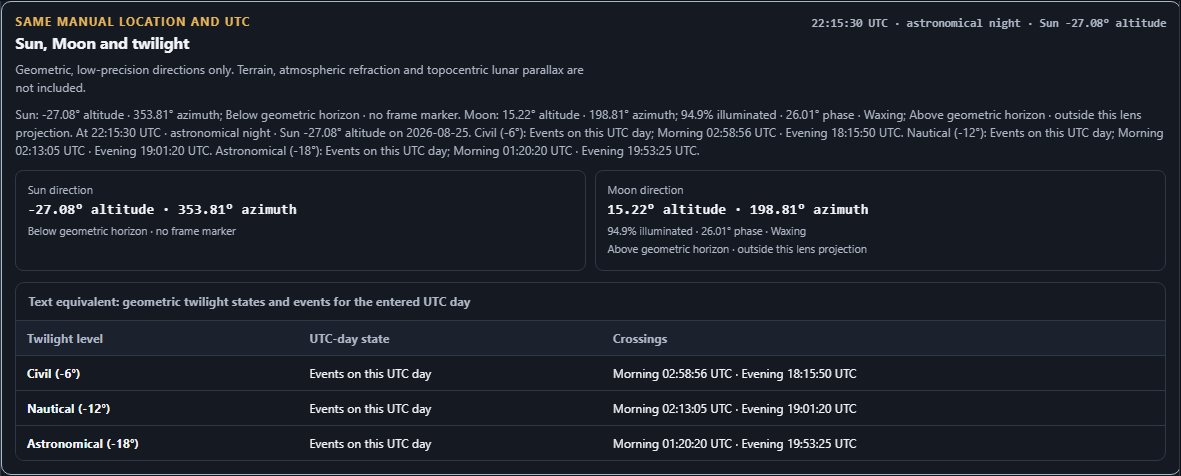
Same manual location and UTC
Sun, Moon and twilight
—
Geometric, low-precision directions only. Terrain, atmospheric refraction and topocentric lunar parallax are not included.
| Twilight level | UTC-day state | Crossings |
|---|
| Frame position | Exposure | Gap | Full sequence | Curvature | Horizon |
|---|
Private full plan backup
This is not the share file above. The strict SkyPlanV1 includes the exact latitude and longitude shown in the controls. Keep it private. It includes no image or sensor data.